Sudan, S. Sudan end first security meeting without agreement
June 7, 2012 (KHARTOUM)- Sudan and South Sudan delegations at the level of the Joint Political and Security Mechanism (JSPM) have ended the first round of talks after failing to endorse a map to establish a buffer zone between the two countries.

On Thursday, the parties ended a three-hour meeting where they discussed the proposal of the mediator, without reaching an agreement. While Sudan’s representatives praised the compromise saying it is based on 1956 border, the South Sudanese sides rejected it.
After the meeting, Sudan’s defense minister, Abdel-Rahim Hussein, held a press conference in Addis Ababa where he announced the failure of the talks and accused Juba of lacking a serious desire to reach a prompt and fair agreement.
He said that South Sudan made new land claims raising the number of contested border areas to nine. Sudan initially said the number of disputed border areas was limited to four.
“The border is based on a map that we have been using for the past six years, but they have included five areas within their border,” Abdel Rahim said.
“We consider it as a hostile action,” he further stressed.
The South Sudanese delegation headed by defense minister, John Kong Nyuon, refused to comment on the failure of the talks but they confirmed that no deal has been reached.
According to Juba delegation the contested areas are: 1- the mineral rich Kafia Kinji area on the border of South Darfur and Western Bahr al Ghazal; 2- the 14 mile area located on the border of South Darfur and Northern Bahr al Ghazal; 3- Abyei; 4- Kharasana and Heglig areas near South Kordofan and Unity states border; 5- Kaka on the border of South Kordofan and Upper Nile; 6- Megenis Mountains located between Upper Nile and South Kordofan; 7- a small portion of land on the border between White Nile and Upper Nile; 8- Gulli area, on the northern border of Blue Nile and Upper Nile states; 9- Chali al Fil on the southern border of the Blue Nile and Upper Nile.
Before the security issues, the row over the border impacted negatively on the implementation of Comprehensive Peace Agreement particularly in the redeployment of troops, wealth sharing, census, and 2010 elections.
The demarcation process, in accordance with the CPA, had to be finalised by a joint technical team before the start of the interim period and immediately after the signing of the 2005 peace agreement a six months frame time.
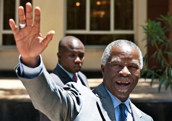
Thabo Mbeki will travel to New York to brief the United Nations Security Council (UNSC) about the latest development in the process and the JSPM members will resume discussions within two weeks.
The ministerial committee was supposed to establish a demilitarised zone along the border between the two countries with joint monitoring team to stop rebel infiltration through the 2000 kilometer border.
Following the capture of Heglig by the South Sudanese army in April, the UNSC adopted an African Union road map providing to end the talks over the disputed issues with three months.
(ST)
